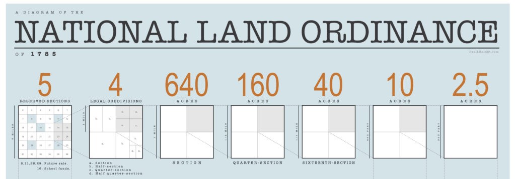
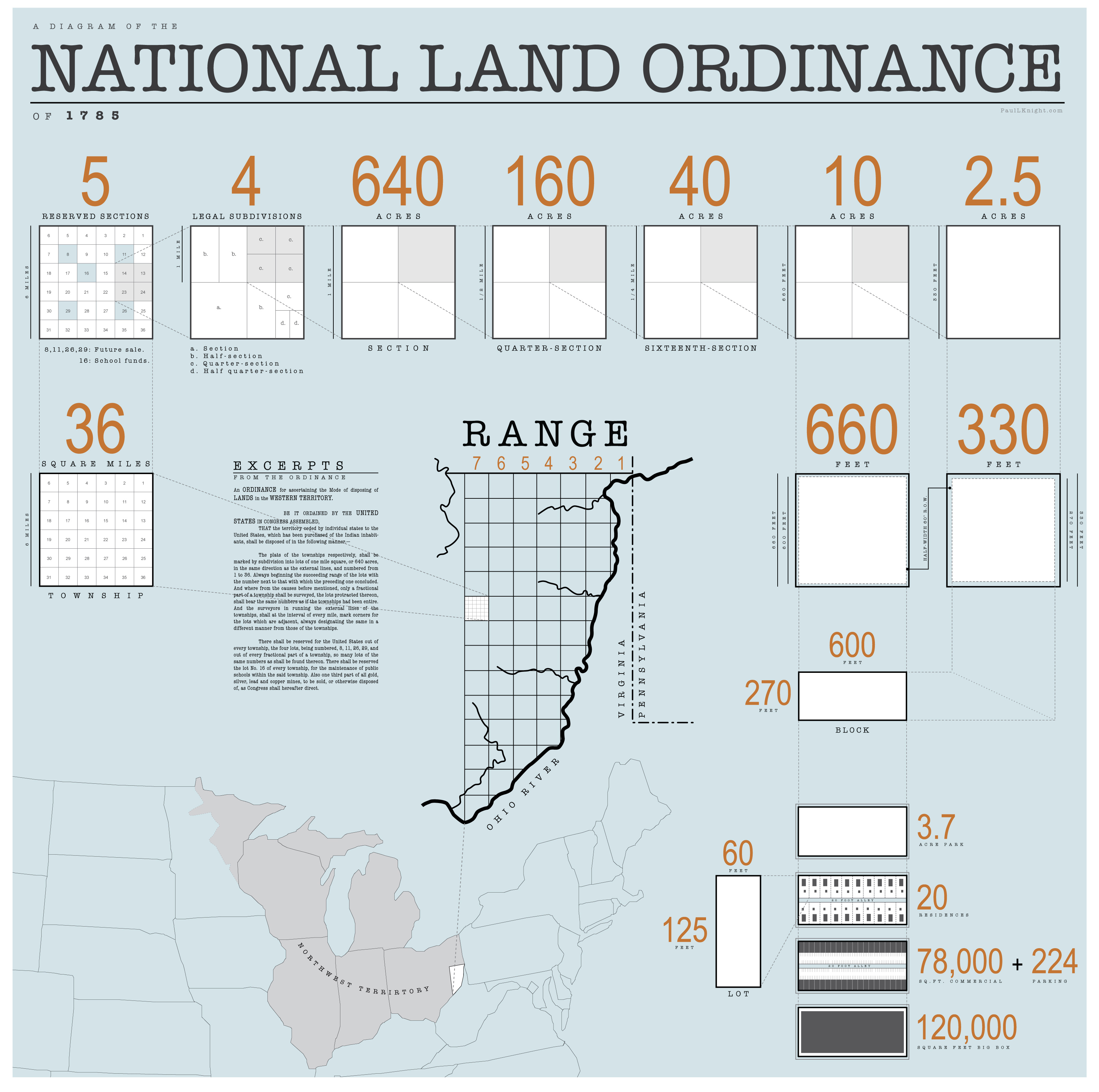
Diagramming the Land Ordinance of 1785 By Paul Knight. Published on April 29, 2016. July 25, 2017 Exploring the dimensional DNA of the ordinance that subdivided two-thirds of the United States. Share this post: Click to share on X (Opens in new window) X Click to share on Facebook (Opens in new window) Facebook Click to share on LinkedIn (Opens in new window) LinkedIn Click to email a link to a friend (Opens in new window) Email Click to print (Opens in new window) Print More Click to share on Pinterest (Opens in new window) Pinterest Click to share on Pocket (Opens in new window) Pocket Click to share on Tumblr (Opens in new window) Tumblr Click to share on Reddit (Opens in new window) Reddit